Topography extraction
Extract topography for an early-stage site study
Select the area you need, review available terrain and mapping information, and prepare related model and drawing views before choosing an export.
Define the extraction area
Start with the design question, then choose a boundary that includes enough surrounding terrain to answer it. A boundary drawn too tightly may omit a road connection or an important change in level. Check current area limits in the application.
Review before downloading
Topography extraction prepares existing data; it does not create a new survey. Inspect the generated terrain for unusual edges or abrupt changes. Missing buildings or roads can reflect source coverage rather than an empty site.
- Confirm the location and selected boundary.
- Check whether the surrounding context is sufficient.
- Compare the terrain model against its plan and section.
- Confirm the offered export options before paying.
What the prepared site can contain
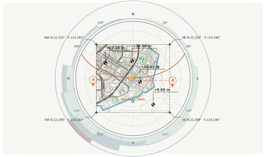
Depending on source availability, the result can include terrain, contours, contextual layers and coordinated drawing views. The application shows the formats and options available for the selected workflow; this page does not promise every format for every site.
Extraction versus a topographic survey
A survey provides professionally measured information for its agreed scope. An online terrain extraction is useful for early understanding but cannot certify property boundaries, utilities or construction levels.
Read the extraction checklist Understand accuracy limitations